Tuesday, November 13, 2012

Do you hear what I hear?

Winter is on the way (yay!) and the Rubies are covered in snow. Not much, mind you, and the trails are very much hikeable. Be sure and wear waterproof boots and gaiters. The road in to Soldier Canyon is going to be closed in the next couple of days, so if you're planning a trip up there you might want to get on it soon. The road up Lamoille Canyon is icy in spots but still passable by car all the way to the end. I was up cross-country skiing on the road a couple of days ago, but that's not really possible at the moment. It'll fill in again, hopefully soon.

 +++++++++++++++

I got an e-mail a few days ago from a guy who ran across my blog looking for hunting beta. Apparently hearing loss has been an issue in his family, and he asked me to publish a short write-up he did for would-be hunters on the subject. As a former owner of a professional sound reinforcement company, and as someone who has experienced hearing loss because I didn't take care of my hearing, I think that what he has to say is worth considering.

Your ears, your choice. Personally I wish now I'd taken more care, as the constant ringing and my unending requests for my husband to repeat himself get old. 

One thing he didn't mention in his write-up: you can have custom earplugs made these days that reduce decibels without changing frequency response. In other words, you'll still be able to hear Ma Nature and your hunting partners while you're out there, it'll all just be quieter. They're great for other overloud situations, as well, like concerts and movies. Here's the link.

One final note: Listening to sound at 120dB for only five minutes can cause permanent hearing damage. Here's a list of decibel levels of common sounds. You'll see that gun blasts are up there in the range that cause permanent hearing damage with very, very little exposure.

 ++++++++++++++

Hi my name is John O'Connor, I am a father, outdoorsman and passionate about living a healthy lifestyle. Over the past few years I have become more and more interested in hearing loss. My father and grandfathers, who are and were all hunters, are affected by hearing loss. I feel that there is a general lack of understanding around the issue and it is our job to spread awareness where we can. Check out my new blog at bloggingwjohno.blogspot.com!

Protecting Your Hearing While Hunting

Hunting is a very popular sport and hobby for many people these days. When planning for a hunting trip many people always check for their rifles, ammo, maps and camouflage but often don’t check to see if they have their hearing protection with him. Because most people begin hunting when they are quite young, many don't think about the consequences of hunting on their hearing at all. However, no matter how young the hunter, being proactive now against damage to the hearing can prevent future difficulties.

My father who as been hunting as long as I can remember, often did not really pay much attention to his hearing while out in the field or shooting at the range. He often felt that if he didn’t see any signs or symptoms of hearing loss why should he have to wear hearing protection. Looking back on it, he regrets that he did not consistently wear some sort of hearing protection when hunting. He now is affected severely by hearing loss and uses hearing aids to help amplify sounds around him so he can hear better.

Are Firearms Dangerous to Your Hearing?

Let's face it: Firearms usually make loud noises. Because hunting rifles are normally positioned close to the ear, hunters are at an increased risk of developing loss of hearing due to exposure to loud noises. The hearing of those accompanying you on your hunting trips can also be negatively impacted.

The average shotgun produces over 160 decibels of sound. If a silencer is used, the decibel level is around 144. This is still over twice as much sound as the volume of normal speech. Fortunately, ear protection that can protect hunters and those who spend time with them are available to ensure hearing safety for all.

Earplugs

Earplugs are among the most commonly used equipment to defend against hearing loss due to high decibel levels created by firearms use. Because different earplugs protect against different decibel ranges, it is important to clearly read the package instructions and explanation before purchase to make certain that you've got the right ones. Although earplugs are the correct answer for many people who are trying to protect their hearing, they are not for everyone. If you aren't getting the protection that you want from earplugs, you should investigate the possible benefits of using earmuffs instead.

Earmuffs

The clamshell-style earmuffs favored by many hunters are comfortable, easy to use and provide superb sound protection. Inexpensive varieties are manufactured with foam padding around the ear area to provide a buffer from sound waves. However, if you are in need of a greater level of protection than these are capable of providing, you should look into earmuffs that have a liquid cushioning as opposed to foam. Many hunters receive more optimal protection by using these.


Electronic Earmuffs

I switched to electronic earmuffs a few years ago and have been happy using them. These earmuffs are designed so that if they detect any sound over 80 decibels, they automatically shut it out. This has allowed me to maintain voice communication with others in my hunting party as well as protect my hearing.

Tuesday, July 31, 2012

There's no place like home...


It's good to be back in the high desert. There was a time in my life that I didn't think that I could honestly say that... I thought that life in Colorado was the be-all and end-all of what a mountain-oriented person would want to find.

I was wrong, and I'm reminded of that every time I return home from a mountaineering trip.

I just got back from Alaska and an attempt on Denali. I was fortunate enough to climb that peak in 2003, and swore then that that trip wouldn't be my last time there. As I am now in my 50th year, I figured that I probably shouldn't put it off for much longer and so have been spending a lot of time these last eight months training for a very big climb. While it's nice to have a gym, it's nicer to have the Rubies in one's back yard. And when I got back, I switched out the stuff in my backpack and headed with my husband to Liberty Lake. I am lucky to live here, and I am blessed to have someone in my life who loves these mountains, too.

+++++++++++++++++++


Mt. Foraker from Denali's 14,000' camp.
This isn't a Denali blog but I'm going to post pictures from the trip here anyway so that I can share them with my friends and family. A lot of folks who don't know me read this blog, too... sorry for the interruption in our regularly scheduled program and I'll get back to Ruby Mountain blogging in the next little while.

+++++++++++++++++++

I started training for this trip last September, as I'd allowed myself to get into pretty terrible shape. Several years worth of injury and the ensuing loss of physical confidence had really worked a number on my body and my mental strength, and part of the whole point of committing to this trip was an effort to reverse the process. FWIW, it worked. ;)

Quite a few of the hikes highlighted on this blog for the past few months, as well as on my ski blog, were training trips for Denali.

I signed up to go with a guided group from the Alaska Mountaineering School. It has been years since I did a climb with guides, as I've been fortunate to have friends and a husband who can usually be enticed into all kinds of adventures. I couldn't put a group together for this one, though, and so signed on with a Talkeetna-based outfit that came highly recommended by the last guide I worked with.

We flew out of Talkeetna on June 27th, along with several other groups that had been stuck in Talkeetna for several days due to weather. It made this trip quite different from my previous one, in that there were a lot more people on the mountain, moving on schedules very similar to ours. Sometimes we looked like (and I felt like) the Chain of Fools.

We carried a metric shitload of gear up there.


Here's Barry, an absolutely delightful gentleman from Ireland via Dubai. Great guy to travel with and to share a rope with. He was pretty stoked about the Roadhouse sweet rolls planned for our first breakfast on the mountain.


Noah, one of the guides. Noah is an absolute hoot - a ski patroller at Big Sky when he's not working for AMS and for Jackson Hole Mountain Guides. He's also a cellist and a very accomplished whistler... a fount of laughter who was wonderful to climb with.


The flight in to Denali Base Camp is utterly spectacular.


Base camp from the air.


We got onto the mountain quite late in the day, and so had just about enough time for a quick dinner and a nap before heading out again at 1AM or so. Smart climbers walk at night on the lower glacier in order to avoid soft snow bridges over crevasses. It never really gets dark on Denali in the summer, though, so the walking is pretty pleasant.


We got to our first camp at 7800' at around 9AM. It was hotter than Hades and we spent a big chunk of the day trying to get out of the sun.


Here is Elyse, digging out our first kitchen tent with Noah. Elyse is a wonder - very young, a recent West Point grad, hugely strong and full of energy. She had no problem at all walking all day carrying and/or pulling a huge percentage of her body weight, and then grabbing a shovel for the biggest camp chores immediately upon arrival.


We spent a lot of time on the lower glacier hiding from the sun. I'm pretty sure it's Laura under all of this stuff. Laura works for AMS in the office and is a hugely adventurous ski-jorer who tackles massive chunks of the Iditarod trail every winter. She is also my age, which was pretty darned nice when you consider that almost everyone else on the team was in their 20's. Yikes!


We did a carry up to 10,200' the next morning, allowing us to enjoy absolutely beautiful color on the peaks.


Looking down the Kahiltna glacier during the carry.


The next morning, after we moved our camp to 11,000', we enjoyed an awesome pancake breakfast courtesy of lead guide Rob Gowler. I have to say that the food on this trip was the best I've enjoyed on one of these little jaunts.

Rob is a pretty amazing guy with whom to share climbing time. The more you talk to him the more you realize how much... life... this guy has fit into the time he's spent on earth. In addition to being a key guy for AMS, he also guides for Jackson Hole Mountain Guides and on Aconcagua, is an accomplished backcountry skier, ice climber, mountain biker and surfer, works in the movie industry doing rigging and other specialized chores, and has refurbished a "short bus" school bus into a lovely living space. I'm probably leaving about half of it out.


The next day we picked up the cache we'd left at 10,300', and the following day we made the first of several trips around Windy Corner. On my 2003 trip, Windy Corner was anything but. It made up for it with a vengance this time around - the wind just howled. We would "enjoy" the conditions on Windy Corner a total of four times during the trip.


Here's Mike, topping Motorcycle Hill on the day we moved to the 14,000' camp. Mike was the team enthusiasm committee - it takes a lot to get this guy down. He was using his climb to raise money - $10,000 worth - for the group Summit for Someone. Very cool.


Charles topping Motorcycle Hill. Charles is a native of France living and working in San Diego. He is a little on the quiet side, and between everybody on the trip hardly got a word in edgewise! It was fun, though... as the trip went on his accent got more and more pronounced, and listening to him and our Irishman Barry talk gave the trip an enjoyable sound.


Heading up Squirrel Hill in a windstorm, on our way to camp at 14,000'.


The 14,000' camp on Denali is a beautiful place, with lots of ghost camps from old expeditions.


We spent a lot of time watching the wind tear on the 16 ridge and at the 17,000' camp. When we got to 14, there were several teams that had been trapped at 17,000' for days by the wind... not safe to go up or down.


View of Mt. Hunter from the 14,000' camp at about 11:30 pm.


After a couple of days of waiting for the wind to settle down, we were able to carry food and equipment to a cache at 16,400'. It was a gloriously beautiful day to enjoy some actual climbing (as opposed to slogging!)


View from our cache down the 16 ridge.


Unfortunately, that was our last shot at good climbing weather during the trip. We got about 2' of snow that night, which wasn't that big of a deal - until you also factored in the massive wind on the ridge. The transported snow created absolutely terrifying avalanche conditions, prohibiting a move up.

We killed a lot of time at the 14 camp waiting for the conditions to stabilize.


On the third day after the storm, the guides from the three groups that hadn't yet thrown in the towel very cautiously tiptoed up the route to see if the snowpack had stabilized. After carefully moving up, listening for whumps and digging pits, they agreed that things were finally safe enough to move up. We were going to get a shot!


Or so we thought.

The next day "dawned", if you can call it that, with more snow and more wind. The unstable snow cycle had started again, and at that point we were out of food and time. The mountain had the last laugh, and we were forced to call it quits for the trip. We, and the rest of the teams up there, had to walk away from our high caches and leave our lonely posessions to occupy the ridge until next spring. One team from Norway even had to walk away from four beautiful pairs of skis. Pretty harsh decision to have to make, but not worth risking one's life for.

We walked down in yet another wind storm and set up camp at 11000' in a blizzard.

Luckily, though, the mountain did opt to give us a beautiful day to walk down to base camp.


Here's Sean, the final member of our team, hanging out while we waited at base camp for the planes that would fly us out. Sean was an intern at AMS, getting experience with hopes of eventually becoming an Alaskan ski guide. He's an absolutely marvelous young man to travel with, and should do well in his chosen career.


Once we got a runway stomped out at Base Camp, the Talkeetna Air Taxi planes started to arrive to ferry us all out. On a few occasions, we had to help them turn around in the soft snow. Not often that you get to push an airplane into place for its takeoff.


So long Kahiltna Glacier! Don't know if I'll see you again. You are beautiful and fickle, and I've enjoyed spending time with you. Be kind to the people who attempt Denali, and thank you for welcoming us.

Sunday, June 24, 2012

Missing in action

I'll be brief since I'm on my iPhone... I'm going to be away from my computer for a few weeks and won't be able to answer emails for a while.
Anyone who wants to share conditions info is welcome to do so here. You cam also check www.backpackingintherubymountains.info There is lots of good stuff there and he keeps that site pretty updated. See you in a few weeks!

Monday, June 18, 2012

Here, fishy fishy...

I'll be the first to admit it... I am not a passionate fisher person. I am a utilitarian fisher person- if I'm hungry I'll attempt catching a fish in order to resolve the situation. Otherwise, I tend to leave them to their fishy lives.

That said, if one plans on catching a fish for dinner in the high alpine lakes of the Rubies and East Humboldts, it's best to know which lakes actually have fish in them.

Here's info from a series of charts that NDOW has up on their website, as well as some information passed along by a reader.

Angel Lake - brook, rainbow, tiger, speckled dace
Birdeye Lake - none
Boulder Lake - ?
Castle Lake - none
Cold Lakes - brook
Dollar Lakes - none
Echo Lake - brook
Favre Lake - brook
Greys Lake - cutthroat
Griswold Lake - cutthroat
Hidden Lakes - cutthroat
Island Lake - brook
Lamoille Lake - brook
Liberty Lake - brook, mackinaw
North Furlong Lake - none
Overland Lake - brook
Robinson Lake - brook
Seitz Lake - ?
Smith Lake - cutthroat
Soldier Lakes - none
Steele Lake - brook
Verdi Lake - cutthroat, rainbow
Winchell Lake - ?

There's some mixed information about Boulder, Seitz and Winchell. According to the NDOW website, Boulder has good fishing for brook trout. However, a reader passed along the information that the fish have been gone from that lake for a few years now, and that NDOW's website is out of date. The bottom line - if you're heading to Boulder Lake make alternate dinner plans.

Seitz isn't one of the lakes up there listed by NDOW as having a fish population. However, Joe Doucette from NDOW listed Seitz as one of the local alpine lakes stocked with cutthroat in a recent fishing conditions column he has in the Elko Daily Free Press. I'd tend to trust Joe on this one - he's the local.

Winchell isn't listed as having fish on NDOW's charts, either, and I've had that confirmed by one of this blog's readers. It's a pretty small lake (although I've pulled really nice fish out of smaller). However, the USFS trailhead sign at the Winchell trailhead shows fishing as one of the recreational options there. You be the judge, although it's quite true that "fishing" is not the same thing as "catching."

One final note - according to Joe there was a significant winter kill event at Hidden in 2010-2011. The lake has been restocked with fingerlings, and the fishing isn't likely to be good there until they grow up in a couple of years. Several friends of mine have had excellent fishing experiences at Hidden, so hopefully this round of trout will have better luck than the previous ones.

Wednesday, June 13, 2012

What a bummer. :(

Well, folks, I hate to say it but I've had to change the comments part of this site so that only registered users can comment. Since just about everybody and their dog has a Google account this shouldn't be limiting, but I have to admit I've enjoyed some of the rhubarbs I've had with anonymous posters over the years. There have been some doozies.

Recently, though, somebody who didn't have the courage to leave his/her name left an obscene comment in a thread under an old, old post. I'm glad I caught it because it would have been a drag for somebody else to have found it. Call me anything you want, I don't care - but (surprisingly to me) a fair number of people read this blog and I won't have THEM abused by cowardly assholes.

Anyway - if you want to leave a comment, from here on out it's going to ask you for a user ID of some sort. When I've done this on other blogs it's allowed me to use my screen name (mountaingirl1961) and so there is a teeny tiny level of anonymity remaining. Again, sorry for the hassle, but this is a prime example of one bad apple ruining it for everybody.

Sunday, June 10, 2012

Conditions update

I took a quick trip up to Liberty Pass today and thought I'd pass along current trail conditions.

The Stock Trail below Lamoille Lake is clear of snow but is muddy for much of its length. The snow banks start just below the lake, but they aren't steep and the snow is pretty supportive... not much postholing once you get past the edges. There is a pretty good stream crossing to get past, but if you look to the left you'll see some rocks you can string together and keep your feet mostly dry. Please don't walk up and down the bank looking for a better spot, you'll just tear it up more than it already is.

The main trail has some significant snowbanks, some of which are frozen and require a fairly steep sidehill traverse. It's not an issue if you're comfortable walking on snow, but I saw a number of people up there in tennis shoes having a fairly hard time. There is also quite a bit of mud on that trail, and people are widening the trail by trying to walk around it. Of the two trails, the Stock Trail is much the better choice right now.

Lamoille Lake is still too frozen over for fishing but is melting out quickly.


Above Lamoille Lake, the trail to Liberty Pass has some snow banks on it but is easy enough to find. You can also walk straight up the snow chute all the way to the pass.


Liberty is still frozen, but Favre is melted out and is yielding hungry brookies.

A few folks questioned the four gallons of water in my backpack up on the pass. I didn't have the heart to show them the dumbbells. ;)

Sunday, June 3, 2012

Flower show in Soldier Canyon

With the dry, dry conditions we've been "enjoying" this year, flowers have been few and far between, much to my dismay. However, usually reliable Soldier Canyon is coming through, and those looking for flowers will do well to head to this somewhat off-the-beaten-path destination.

There's no possibility that Soldier or any other canyon in the Rubies this summer is going to have the riotous display that we saw last year. But, I saw a very nice array of arrowleaf balsamroot, penstemon, rock geranium, columbines, chokecherries, etc. etc. etc. Certainly plenty to provide happy respite for my flower-starved soul.

It's gorgeous up there right now, and spring is slowly marching to higher elevations. As I gained elevation walking up the trail, the flower show morphed into blooming serviceberry bushes, and then into a generous scattering of buttercups. And then into plants just coming out of winter dormancy. There were butterflies everywhere, and a symphony of birds, bugs and chuckling creek... dappled sunshine and wide open Nevada blue skies. And I had the whooooooooooole place to myself.

It doesn't suck living here, truly.

++++++++++++++++++++++

If you're going to head up Soldier Canyon, or to any lower-elevation destination in the Rubies, be aware that there are rattlesnakes around. This isn't a deal-killer as far as trip planning is concerned, because they're every bit as interested in avoiding you as you are in avoiding them. Just stay on the trails, be deliberate about where you're putting your hands and feet, and give them plenty of room to get away.

Rattlesnakes are very courteous animals, when you think about it. They let you know they're there, generally before you get close enough to cause problems for them. Show them the courtesy of not harassing them, and let them get back to their jobs of keeping the rodent population under wraps.

A bit of rattlesnake lore from my rancher dad, who knew these mountains better than I ever will: common "knowledge" among the old timers here is that there aren't any rattlesnakes above the elevation of Scout Camp in Lamoille Canyon, at about 7200'. Couldn't tell you how accurate that is, but the fact is that I've never seen a rattler above that elevation, and I'm willing to bet that my dad didn't, either.

Another tidbit from my dad: stay out of rattler territory in late July/early August, when they're shedding their skins. He always told me that they were a lot more irritable at that time of the year, as well as about half blind. I was never interested in testing the theory and so have avoided lower-elevation trails that time of year. Those trails tend to be hot and dusty in August, anyway.

Here's a write-up on today's destination, Hidden Lakes.

++++++++++++++++++++++

HIDDEN LAKES

Length: 10.5 miles RT from Soldier Creek trailhead

Elevation gain: 2734'

Difficulty: Class C (moderate, all on trail)


The Hidden Lakes are a pair of glacial gems tucked up on a bench above Soldier Basin. Now that they've signed the trail turnoff they're not all that hidden any more, but back in the day you pretty much had to know they were up there to go looking for them. They're not all that obvious until you're almost standing in them.

This hike is quite different from many in the Rubies. For one, it's much lower elevation, meaning that you spend a fair bit of time walking through the dappled sunshine of aspen groves. You walk uphill through a narrow canyon, alongside the boisterous Soldier Creek, until suddenly the canyon opens up into a beautiful mountain basin, with gentle slopes and only a scattering of trees. The grade slacks off considerably and it becomes a very mellow walk. The lack of shade makes this a better hike very early in the morning or at times of the year when it's a bit cooler out. You'll be sharing the area with a lot of hunters in the fall, so if that's not your gig you might want to find another destination.

To get to the trailhead, drive through Lamoille until the pavement ends at a T intersection by the Lamoille Church. Turn left, and then turn right when the road makes another quick T. Stay on this road as it roughly follows the line of foothills at the base of the range. After the road dips to cross Cold Creek, look for a small brown sign at about 10 miles that says "Soldier Canyon" and points to the right. Go through the gate onto a somewhat rougher road (still passable by passenger car) about 6 miles to a small turnaround with an outhouse and a hitching rack. Park here unless you have a high-clearance vehicle and don't much care about your undercarriage.

You'll immediately cross Soldier Creek and then walk up the jeep road for another 3/4 of a mile or so until you reach a USFS kiosk and a gate blocking access by the ATVS that were continually encroaching on the trail. (Thank you, Backcountry Horsemen).

The trail is a bit rocky at first as it climbs through the aspens, gaining elevation at a 13% clip. It smooths out pretty quickly, though, and is downright pleasant walking. The canyon gets narrow and the creek gets closer, until fairly suddenly at about 2.25 miles in the canyon opens up, the grade slacks off a bit, and you leave the aspen forest for a scrub hillside.

For the next 2+ miles, you'll follow the creek as it and the canyon bend around to the right, still gaining elevation but not steeply at all. The plant communities will change as you gain elevation, until you start to see limber pines and skunk cabbage.

You'll pass the turnoff to Ross Creek and the Krenka Creek trailhead at about 3 miles. Those rough trails will get you to places very few people other than hunters go. Good stuff for those with adventure in their souls.

At a little more than four miles, you'll see the first of the tarns that have collectively earned the name Soldier Lakes. There are five of these tarn-sized lakes up here, all of them lovely in their own ways. Soldier Basin itself is fairly treeless and windswept, and very open.

At 4.5 miles you'll see a new-ish sign marking the turnoff to Hidden Lakes. It's pretty obvious which of the two forks gets more traffic - and it's not the fork we're planning on taking today.
The trail to Hidden Lakes pretty immediately overlooks the largest of the Soldier Lakes, and makes its way up a mellow grade on wonderful tundra slope. The tread is very thready but it's impossible to lose your way as it's marked by the most obvious rock cairns in the Rubies. They immediately brought to mind the signal fires of Gondor. If you do manage to lose track of the next cairn, just stop where you are and look around. You'll see it.

Oddly enough, the cairns will dump you onto a beautifully benched trail that contours around the hillside and takes you the rest of the way to the lake. If I had to guess, it looks like somebody started rebuilding the old trail from the lake on down, and ran out of money, oomph or weekends about half-way into the project. At any rate, the trail's great and will get you where you need to go.

You'll come up on the twinned Hidden Lakes right at 5.25 miles.

As at most lakes in the Rubies, there are far more fire rings than necessary, all of which are filled with burnt cans and broken glass. I didn't have a garbage bag with me today... if you head up there, bring one along and pack some of that stuff out of there. If we all take a little none of us will have to take a lot and eventually it'll get cleaned out.

There are tent sites at the south end of the southern lake, if you're up for an overnight. There are cutthroat trout in these lakes, although they had a big winter kill event in 2010-2011. They re-stocked the lake last year with fingerlings... too small to keep. Give them a couple of years to grow up before trying to tempt them into your frying pan. There are lots of brookies in Robinson Lake down the hill, though, so you don't have to go hungry. To get to Robinson, walk back downhill to the main trail, hang a right, walk past (fishless) Soldier Lake a few hundred yards to Robinson, the last (and largest) lake on the bench.

Here's the map. Click on it to make it larger.

One final note: this is a great opportunity to give a shout-out to the Backcountry Horsemen, who have been the ones maintaining the Soldier Creek Trail for years. Without this group of volunteers the trail would be ridiculously overgrown, much more eroded, and a significantly less pleasant place to visit. Thanks, folks, for all of your hard work over the years!

Sunday, May 20, 2012

A quick conditions update

I drove up to Road's End yesterday for a very quick hike up to Island Lake.  One of the things I love about these mountains - if you're training for a big climb somewhere they provide lots of options for training terrain.  Right now I'm teetering around in mountaineering boots carrying a 50-lb pack, getting ready for a trip to Alaska this summer.  I look funny, of course, but then I always do...

Anyway - the snow line on east aspects right now is at about 9600', which on the Island Lake trail means that it's clear all the way to the lip right below the lake.  That trail is pretty much dry, with a few spots where melt water is running down the trail.  The Ruby Crest Trail on the way to Lamoille Lake is snow covered starting at about 9200', with a lot of mud and running water right now.  That route is, by far, much easier to hike at about 6AM before the snow softens up and it becomes an adventure in postholing.  The Stock Trail will be clear much earlier than the regular trail will be, although there is a lot of running water crossing that trail right now.

The Secret-Lamoille Trail is, of course, open as far as they have it constructed.  The gate at the bottom of Soldier Canyon is open... I haven't been up there yet but there's no question that it's open to the end and that the trail is likely open for much of its length, too.  I'll do a real report in a few days.  If you're heading up to Ruby Dome on the Hennen Canyon Trail, you'll hit snow below Griswold Lake.

The lakes are thawing but they are not clear yet.

++++++++++++++++++++++

This provides a great opportunity to talk about how NOT to cause damage while you're up there hiking in the spring.  It's our responsibility to take care of these mountains.  They are beautiful, and they are fragile. Watch your feet!

If the trail is blocked by snow or gushing water, you're going to be very tempted to leave the trail and walk around.  Think very, very hard before you do.  You're likely to be walking on mud and tearing up plants - the beautiful stuff we go up there to see.  Just say no to walking in mud!  Stay on the trail if there's any way you can do it.  It's there for a reason - to protect the mountains from resource damage done by people up there to enjoy them.

You CAN get around up there without doing resource damage if you're careful.  Don't be afraid to get your feet wet by walking on snow.  Snow is the best stuff up there to walk on if you're not going to be on-trail, because you can't hurt it.  If you think you're likely to be walking on snow, start very early in the morning - at dawn or before - to get up there before it thaws.  It's an excellent walking surface when it's frozen.

Your next best option is rock - there are lots of very conveniently placed rocks up there that provide good, safe footing wherever you want to go.  Make a game of it - pretend you're a kid crossing a creek.  You probably won't have to pretend much with that one because you WILL be crossing creeks and looking for  rocks!  Rocks are your friends, and what's more, they're the mountain's friends.

If you can't find snow or rocks to walk on, go for gravel.  Gravel isn't as durable a surface as the previous two, but in all likelihood nothing's growing in it and it will prevent you from sinking in and tearing things up.

AVOID AT ALL COSTS mud off-trail and walking on plants, whether they're growing or dormant.  They have a hard enough time trying to get by up there.  We don't need to make it worse.  One muddy footprint multiplied by hundreds of people means damaged streamsides, damaged trails, dead plants and erosion.  Don't do it.  If you can't get around an obstacle without walking on mud or plants, call it a day and come back later.  The mountains will still be there next time.

Saturday, May 19, 2012

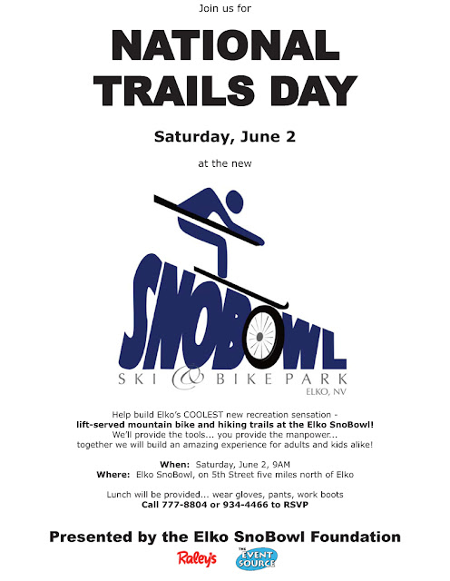
National Trails Day June 2nd

My favorite holiday is on its way!  No, not Christmas, although I'll admit that's how I often feel at the end of the day.

It's National Trails Day, June 2nd at a trail near you!

This year I'll be celebrating National Trails Day at the Elko SnoBowl Ski & Bike Park, five miles north of Elko on North 5th Street.  We'll be working on two projects - one, finishing some benching work on the beginner MTB trail up there, and two (really exciting to me) beginning work on a NEW cross-country trail system.  We'll be building a trail that leaves the SnoBowl parking lot and heads up to the saddle looker's right of the top of the lift.  It'll be designed for two-way bike traffic and will be perfect for hikers and trail runners, too!

If you live in or near Elko, come on out and join us.  We had almost 60 people out there last year... we got a lot of work done, enjoyed a great lunch, and played on the new trails in the afternoon.  If you DON'T live near Elko, then find a Trails Day project near you.  If you love trails, volunteer!


Monday, May 14, 2012

Travel management redux

This is a cross-post from my ski blog, Ruby Mountain Ski Days.  Read through to the end.

There's Corn in Them Thar Hills

The motorized user crowd is tearing up the land at the head of Lamoille Canyon, right now.  The snowmobilers aren't content to let their season end... no, they're driving their machines up the Stock Trail and over the willows to access the snow that starts hundreds of feet from the end of the pavement, creating a huge erosional mess in a very, very fragile area.

Where's the outrage, folks?  Why are we even TALKING about continuing to allow motorized off-road travel?  Oh, that's right, it's Elko County, where we grow 'em stupid and with motors.

Sunday, January 22, 2012

Snow hike in Right Fork

Well, it looks like winter is FINALLY here. And about darned time, I say.

Bruce, RJ and I decided to go out and celebrate by hiking about four miles up Right Fork Canyon yesterday, right into the teeth of the blizzard. We had an absolute ball - smiles all around, when we didn't have our heads down trying not to get sandblasted by the wind and blowing snow. The blizzard conditions were pretty much limited to above the bench - below that, it was a beautiful, calm snowfall.

Just goes to show how variable things can be up there.

We were able to drive all the way to the Right Fork trailhead. It was obvious that the storm had started out as a slushfall - there were about three inches of slush underneath the skiff of snow that was showing. There had been no snow up there in recent weeks, so we decided to leave the snowshoes in the truck and hike it. Not a bad choice, although snowshoes would certainly have been appropriate a couple of miles in.

We crossed the creek at the higher of the two creek crossings just past the Scout Camp. The little bridge is gone, but the water is low and the rocks are placed appropriately to keep one's feet dry.


HooDoo, a favorite ice climbing destination. Don't know that it's been cold enough recently for this to be safe at the moment.


For the most part, once we got above the Scout Camp, the snow was mid-shin deep to just below the knees. It was over-the-knees in a few places.


Once we got above the bench, we were able to hike almost to the creek crossing before the blizzard really started blowing up. A good place to turn around and head back.


So beautiful up there in the winter.

We turned around right at 8600', which is a little lower than the Lamoille Canyon Road turnaround. There are still a lot of willows showing and no base to speak of.

Figured I'd stay out of the canyon today since there is bound to be a million snowmobiles, will hopefully head up to the turnaround tomorrow on my sled and see if it's skiable yet. Given the avalanche conditions, if I do ski it'll be a meadow-skipping kind of day.

Friday, January 20, 2012

Hike classifications

It's been a while since I've posted an update. I tore up my left Achilles tendon several weeks ago - how, I couldn't tell you, but likely from not being as conscientious about stretching as I could/should be. Getting old ain't for sissies, and my days of bounding out of the truck and onto the trail are likely over. Warm up first, please.

At any rate, I've gotten a bit of grief from folks for the (extremely subjective) ratings I've given some of the hikes for which I've provided beta on this blog, most particularly my most recent write-up on Griswold Lake. What's "easy" for me may be less so for other folks, and what I might consider something that should earn a "difficult" rating could be a cakewalk for another person.

Fair enough. Let's take the subjectivity out of it.

Back when I lived in Colorado, I was a member of the Colorado Mountain Club. They have tens of thousands of members and needed a workable rating system to make sure that people signed up for the hikes they were interested in and/or qualified for. Their rating system did a pretty good job in letting folks know what they were in for, so (since plagiarism is the highest form of flattery) I'm going to steal it wholesale. Not only that, but as a courtesy I'll go back and update the ratings I've given various hikes on this blog to reflect this rating system.

Fair enough?

OK, here it is, straight from the CMC website:

Hike Classifications

Hikes (including some trips that require rock-climbing skills) are normally classified as A through D:

Class A: Up to 8 miles round trip and 1200 ft. elevation gain. (Prior hiking experience is usually not necessary.)

Class B: Up to 12 miles round trip and 2500 ft. elevation gain. (Moderate to strenuous physical activity. Some prior experience is beneficial.)

Class C: Up to 15 miles round trip and 3500 ft. elevation gain. (Strenuous to very strenuous physical activity. Prior experience and training is beneficial.)

Class D: Over 15 miles round trip or 3500 ft. elevation gain. (Very strenuous physical activity often including exposure or requiring use of technical skills. Knowledge based on prior experience and training is highly beneficial.)

If you also see the letter "E" after the classification (such as C-E or D-E), the trip involves exposure (i.e., risk of falling) and may require advanced climbing skills.


Got it? That should be easy enough. Since a lot of the hikes around here require route-finding skills, I'll add an "R" after the classification to indicate that, too.

I'll put a link to this post at the bottom of my trail beta from here on out. FWIW, I pretty much considered Class A and B hikes to be "easy" hikes back in my CMC days, C hikes to be "moderate" and D hikes to be the ones most worth doing. ;)